Our services.
We provide Design and Drafting Services for all aspects of a Pipeline Project. From Alignment sheets to Above Ground Piping and Site Grading. We have our own Licenses to all major Design/Drafting Software. Scroll below to read about some of the services that we provide.
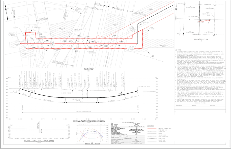
Alignment Sheets
We have created over 5000 miles of Pipeline Alignment sheets using the latest softwares in the industry, combined with in-house developed techniques. Every Alignment Sheet created by us comes with advanced reports and tables that helps the construction process. All the data in Alignment Sheets is location based and can be easily exported to PODs and other GIS related databases.

HDD Drawings
We are proficient in creating HDD Drawingss and can process Lidar and Surveys in various formats. We also create HDD Stake ID reports and pcf files (or 3D lines) for Stress Analysis purposes.
ILI Processing
We have vast experience in Processing ILI data and presenting it in a manner that assists in Pipeline replacement projects. We can present ILI data in Plan and Profile manner or as a KMZ or other GIS based format.

Right-of-Way Grading
We have experience with creating Grading models of Miles long Pipeline Right-of-ways and calculating related cut/fill and stripping quantities.

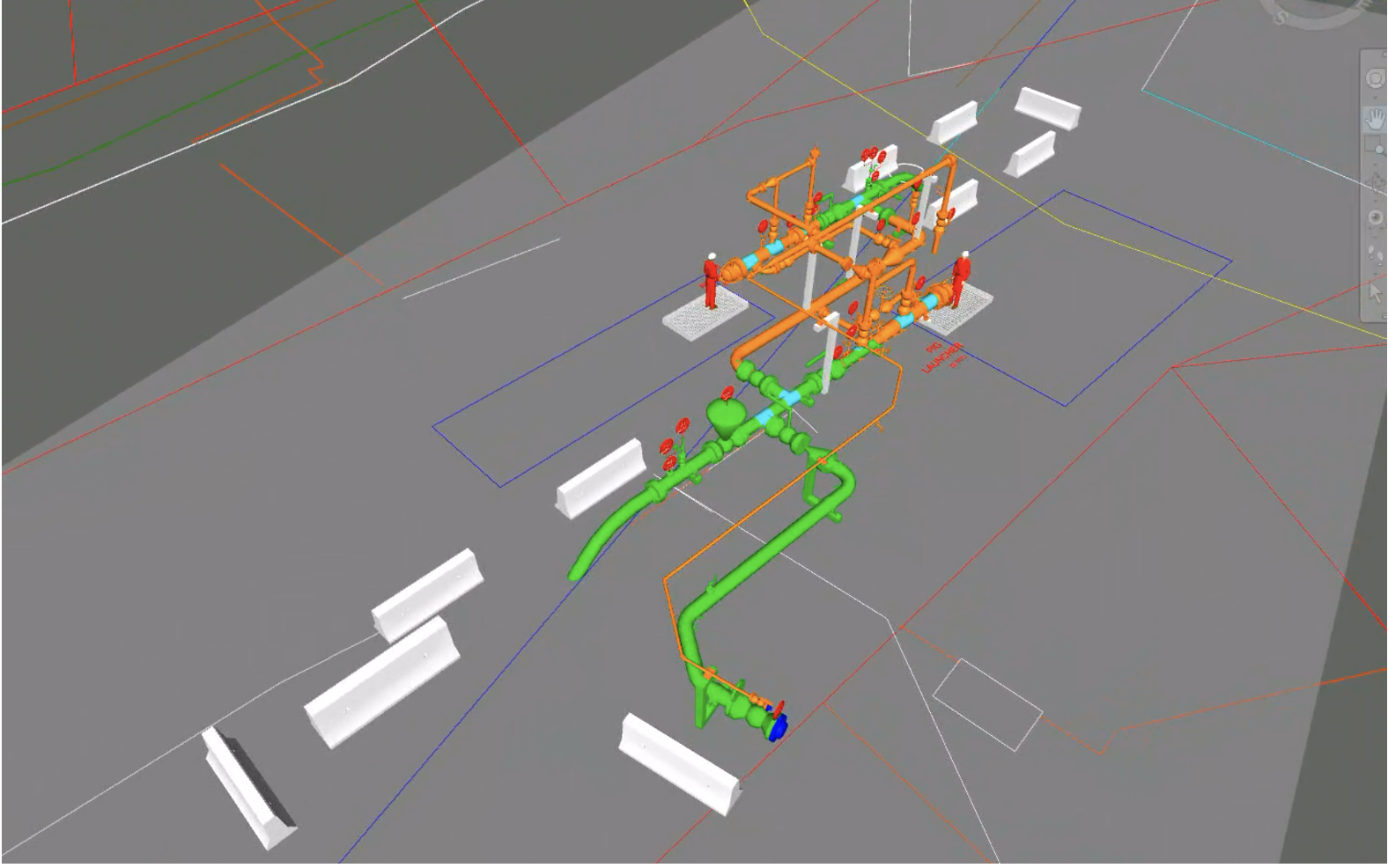
Piping
In order to provide Drafting services for a complete Pipeline Project, we also create Piping models for Valves sites and Riser sites. We are proficient in Cadworx and AutoCad Plant 3D modelling, creating ISOs, BOMs, Plot plans, PIDs and PFDs.
Site Grading
We are also proficient in creating Civil Site Grading packages. Creating earthworks volumes, drainage and access design.

Survey Processing
We can process Topographic and Aerial surveys in various formats- Lidars, point files, laser scans, xml files etc. We are also proficient in Surface modelling which combines Aerial survey (lidar) with Topographic Surveys (ground survey) to obtain the most accurate ground representation.
GIS/Mapping
We can import and export GIS data in various formats. Our Alignment sheet process is fully location based and all the data can be converted into shapefiles, KMZs, XYZ files etc. We are also efficient in browsing various Public Databases for obtaining imagery, lidars or other GIS layers.
PODs
Our Alignment Sheet create location based data that can be easily uploaded to PODs.
Stress Modelling
We can create .pcf files, xyz files, 3D polylines for complete Pipeline routes, HDDs and Above Ground Piping.
Road Design
We can also create Road Design packages. This is useful for designing Access to remote Valve/Riser sites.